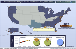
 Great interactive map from the NOAA Coastal Services Center quickly tells you for any state:
- Population growth of the Coastal Flood Hazard Area (CFA)
- Percentage of people living in the CFA who are:
- Living below the poverty line
- Over 65 years old
- What percentage of the state’s total land area is within the Coastal Flood Hazard Area
How does Mississippi do? Better go have a look at NOAA’s State of the Coasts website.